Day 2: Asulkan Valley Trail: Glacier National Park
Day 3: Iceline Trail: Yoho National Park
Day 4: Abbott Ridge Trail: Glacier National Park
Day 5: Nakusp Hotsprings Trail
Day 3: Iceline Trail: Yoho National Park
Day 4: Abbott Ridge Trail: Glacier National Park
Day 5: Nakusp Hotsprings Trail
 |
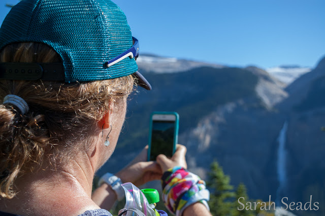
| Taking in the awesome view of Takakkaw falls. |
Run BC Project Day 3: Iceline Trail, Yoho National Park
Day 3 of the Run BC Project saw us driving to Yoho National Park from our accomodation at Kicking Horse mountain in Golden. There are some beautiful homes to rent on the mountain as well as an awesome restaurant to enjoy in town - 1122 (how is this fantastic gem in this wee town?). You MUST go for post a post adventure stub and grub if you are in the area.Distance: 20kms - loop (many options for out and backs, view points or shorter loops as well)
Elevation: 900m approximately
Terrain: Steep forested switchbacks (if you go clockwise) at the start, rocky traverse in the middle (exposed/no shade), sweet flowy singletrack along a river at the end of the loop (back in the shade).
Water: Many rivers flow across the trail from the Emerald glacier on the traverse.
Bring: Sunscreen (exposed up top!), bear spray (grizzly country!), camera (and spare cards!) and emergency communication device such as the Delorme inReach (no cell service).
Map:
Trailhead: Whiskey Jack Hostel, park at the Takakkaw Falls parking lot and walk back down the main road about .5kms to the Hostel to find the trailhead. No parking allowed at the hostel fyi.
 |
| Photo of a photo of the falls;) |
 |
| Running through history on the morraine. |
 |
| Crossing one of the many glacier feld creeks. Daly Glacier in the background, across the valley. |
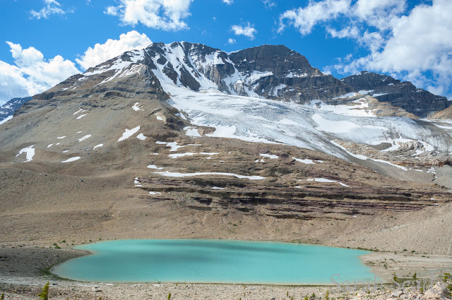
Underfoot, is ancient scarified morraine rock- once covered by this shrinking glacier. The terrain is otherworldly and the rock fields create a moonscape that makes you feel like the tiny speck you are!
Beautiful alpine tarns, magestic mountain views and that massive glacier all follow you as you traverse the route.
 |
| Of course we have to go to the top of this thing! |
 |
| Photo op! |
 |
| Life is good and I am full of life! Wahooo! |
There is an awesome lookout on a spiney ridge about half way through the route, that is the perfect spot for a photo shoot if you dare!
 |
| Wicked views every which way. |
 |
| Little raspberries in the moonscape. |
 |
| Trail running dreams. |
 |
| Leaping across cold creeks! |
 |
| Yup. Its for realz. |
Eventually, the trail drops back down into the subalpine and the trees begin to grow larger as you descend into the valley below. Wildflowers, squeeky marmots, butterflies and lovely cool temperatures greet you in the forest. Then it is downhill on lovely singletrack all the way!
 |
| Brianna rockin the sweet alpine singletrack. |
The trail passes one of a few cabins that are available for rent along the route and there was a family reunion underway the day we ran by! What a great idea! On the way out, the trail passes by the beautiful Twin waterfalls and a great spot to cool off and grab a drink.
 |
| River crossing near the cabins. |
 |
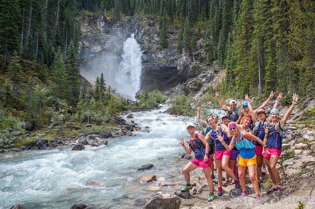
| Twin Falls! |
On the homestretch now, the trail finishes on a wide double track path that leads right to the Takakkaw parking area (campground and washrooms as well).
 |
| Finishing the loop... |
 |
| Back to the beginning and the impressive Takakkaw falls. |
Takakkaw falls welcomes you back to your car with it's wild roar and lovely mist! What a fantastic place to play! The most beautiful trail in the Rockies? I'll just have to go back and do a few more before I can confirm or deny that...but so far I would say it is up there with the best of the best!
 |
| Hi fives all around! Way to go ladies! |
Happy Trails!
1 comment:
Such an amazing day you must have had. Thanks for sharing such incredible pics. Out of this world. Brilliant. Cheers from Ontario
Post a Comment